On 23 March 2017, I embarked on a second trip around Australia. This trip was different from the first trip in 2011 in that I am proceeded in a clockwise direction…Brisbane to Sydney to Melbourne to Adelaide to Perth. After a four week break in Perth (for a hiking trip in France), I moved onto the North West part of the Australia (Broome, Dampier Peninsula and the Kimberleys). After the Kimberleys, the next destination was Alice Springs and the Red Centre for two weeks followed by a backroads trip across to Cairns and then eventually back to Brisbane by mid August.
The trip is broken into 2 sectors: Brisbane to Perth and Perth to Brisbane. A brief description of the first sector activities plus selection of photos are provided below. The second stage is on a different page under Perth to Brisbane.
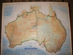
Round Australia Routes – Pink route was completed in 2011 while blue route is the 2017 trip
BRISBANE TO MELBOURNE (via Snowy Mountains)
This sector started with a weekend with my son, daughter in law and grandson in the beachside village of Sawtell near Coffs Harbour on the central NSW coast. Grandson is now 3 months old and very cute. After Sawtell I had big day of driving to get to the Royal National Park south of Sydney. The most direct way to reach the RNP is to cut across Sydney. Even on Sunday afternoon, this took over 90 minutes.
From RNP I drove down the coast to Narooma for one night where I was nearly blown away by a short, vigorous thunderstorm. From Narooma I turned inland to the Snowy Mountains and camped at Jindabyne. The next day, I drove to Thredbo village (mostly known for its winter skiing activities) to take the one operating chairlift to the mountain top to access the path to the highest point in Australia, Mt Kosciuscko (2228m). The peak is a short 3 hour return walk along a boardwalk which protects the mountain environment from thousands of visitors each year.
From Thredbo, I followed the Alpine Way through the Snowy Mountains and stopped at a small village called Khancoban for the night. From Khancoban I passed through Corryong which was about to host the Man from Snowy River Festival…one of Australia’s most iconic festivals. The village was full of urban “stockmen/ladies” dressed in pressed denim jeans and pristine Akubra hats which clearly only come out once a year for the Festival…!!
From Corryong, I made my way to Paynesville on the Gippsland lakes where I met up with some friends and spent the afternoon sailing on their 42ft yacht…nice ending to the first week of my trip..! From Gippsland, I then moved onto the west side of Melbourne to spend a week with cousin Tony and his wife Ceri in the quaint village of Trentham. This ended the first 2500km sector of the trip. Photos follow:
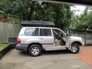
Setting out from home in Brisbane on 23 March 2017
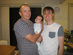
Three generations of Heathcocks…!
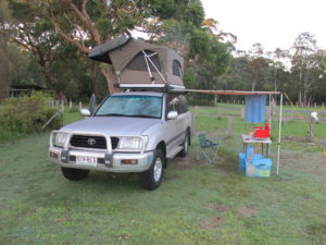
Camp setup…electric operated rooftop tent and pullout awning…so much easier than my 2011 equipment.
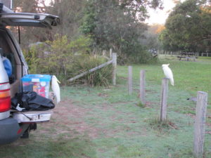
Cockatoo trying to open my foodbox…and he succeeded after a few minutes…!
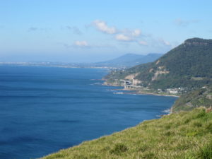
View down coast from Royal National Park
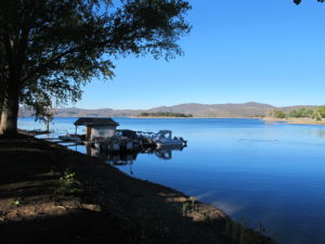
Camp on Lake Jindabyne
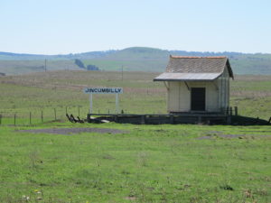
Iconic country train station in high country
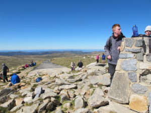
Top of Mt Kosciuscko…with about 100 other humans…!
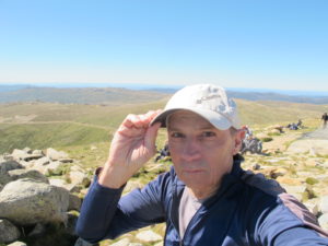
Selfie at the top of Australia
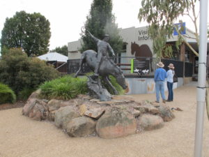
The Man from Snowy River sculpture in Corryong with two urban “cowboys”
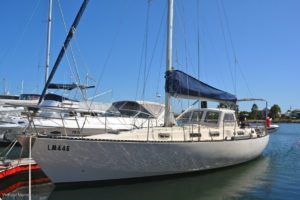
The yacht that provided a wonderful sailing experience on the Gippsland lakes
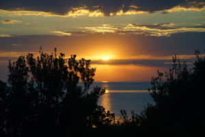
Sunset over Port Phillip Bay, Melbourne
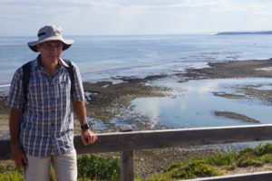
From Point Nepean overlooking entrance to Port Phillip Bay
MELBOURNE TO PERTH
First day of this leg covered Melbourne to Port Campbell on the Great Ocean Road. To say the least it was an interesting weather day. It started off reasonably well with overcast skies and light rain. However in the afternoon, it turned into a mighty storm with howling winds and horizontal rain coming off Bass Strait. And all this happened as I was driving from Apollo Bay to Port Campbell through the Otway Forests. Large trees were falling like skittles across the road. Fortunately I was able to squeeze past them and make my way to Port Campbell safely. Quite a hazardous journey…I was half expecting to be flattened by a large tree…end of Round Australia 2 Trip…!
The storm abated overnight. Next morning the weather was still windy and overcast but no rain…normal weather for this coast line. Needless to say, I did not camp overnight. Fortunately the local pub had a cheap room and meal which I purchased with much relief. In the morning I backtracked about 10km to view the famous Twelve Apostles Coast and then continued on my way westards. The second day took me through to Portland in Western Victoria via the pretty seaside village of Port Fairy. Third day covered Portland to Kingston South Australia. This was a lovely drive through pine plantations, rolling farmlands and pretty seaside towns especially along the Southern Ports Highway in South Australia. Photos follow:
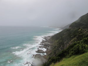
Wild weather on Great Ocean Road
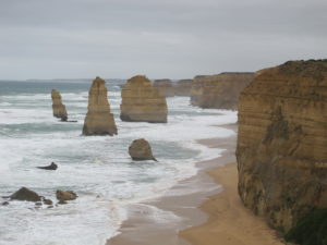
Twelve Apostles…actually only ten left now as two have collapsed
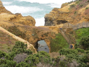
The Grotto formation
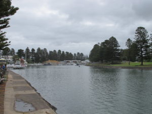
Port Fairy Inlet with its wonderful pine trees
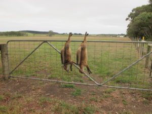
Colonial legacy in far western Victoria
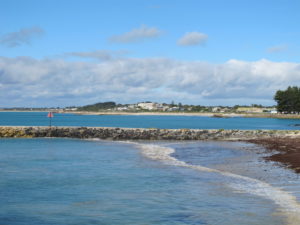
Pretty seaside town of Robe with aquamarine water
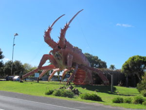
Aussie country towns love their big icons to reflect their major industry…this lobster is at Kingston, South Australia
The next leg of the journey was all about skirting around the extensive lake system at the mouth of the Murray River…The Coorong (major Pelican breeding ground and home to many other birds as well), Lake Albert and Lake Alexandrina…twitchers paradise..! Overnight stop was at Cape Jervis which is the Kangaroo Island ferry departure point. Worst campsite so far with major traffic passing (going to Kangaroo Island) and worst ablutions ever (the key rating point for campsites)…unusual for Aussie campsites because most are very good. Also was “attacked” by an aggressive Emu that thought my phone was a breakfast snack…10 minute standoff with Emu. Hope no one was watching because it would have been like reality TV watching me fending off the Emu..!
Next day was a battle to get across Adelaide from south to north in pre easter traffic…took two hours as have to go through city due to lack of ring road..! Then entered rolling wheatlands very similar to Swartland in South Africa. Overnight stop was in small town of Peterborough. Today (Good Friday) I proceed to the Flinders Ranges named after Matthew Flinders who was the first to circumnavigate Australia. Photos follow:
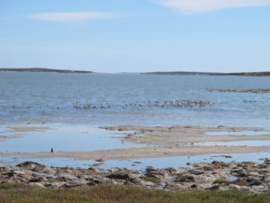
The Coorong at Murray River mouth…major bird feeding and breeding area
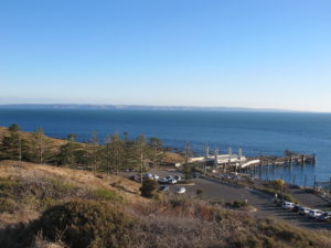
Cape Jervis at tip of Fleurieu Peninsula with Kangaroo Island in background
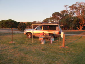
Camp at Cape Jervis
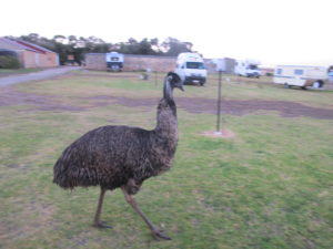
The aggressive Emu that thought my phone was a snack..!
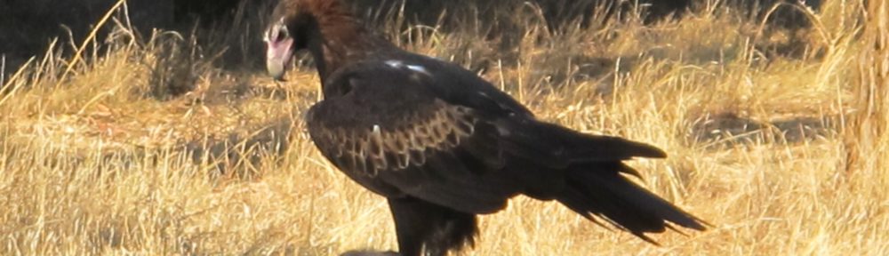
I spent Easter weekend at the Flinders ranges. After hearing so much about the ranges over the years, I was a little disappointed with the experience. The centre part of the range is an interesting structure…like a bowl. It is known as Wilpenna Pound because the mountains form a closed, round valley with only one entrance. In the 1800’s graziers decided to run sheep in the pound….120,000 of them…! Needless to say they ate every bit of greenery in about 5 years….end of sheep farming in the Pound…! It is a national park now but personally I did not find it very inspiring. However one event this morning made it all worthwhile. I captured a magnificent photo of a wedge tailed eagle. It was a very lucky shot because Wedgies don’t normally stick around to be photographed…! But this one did…see below. I am back at the coast now in Port Lincoln. Very happy to be back at the sea after the dry and dusty interior…!
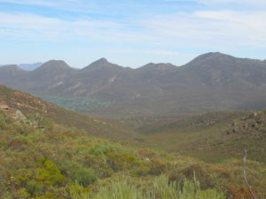
The western end of Wilpenna Pound in the Flinders Ranges
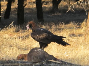
My lucky shot of wedge tailed eagle snacking on Kangaroo roadkill…!
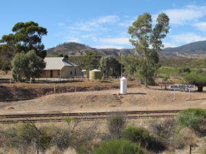
Classic Australiana between Hawker and Port Augusta, South Australia
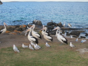
Pelicans and others snacking on fish offcuts – Port Lincoln, South Australia
Today’s leg…Port Lincoln to Streaky Bay was uneventful. I dropped into several pretty coastal village…Coffin Bay (not as macabre as it sounds… was named by Matthew Flinders after Vice Admiral Isaac Coffin), Elliston and Streaky Bay where I am staying tonight in a brand new caravan park with all the latest bells and whistles…very nice. A few photos follow of the dramatic coastline on this side of the Eyre Peninsula.
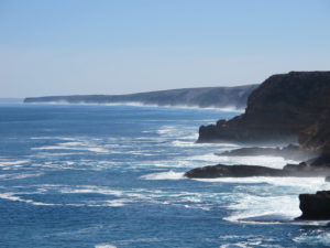
Coastline at Leo Cummings Memorial (named after crayfisherman who drowned here in 1959) between Coffin Bay and Elliston
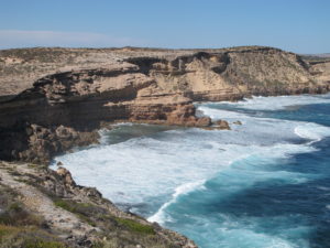
Same coastline in other direction
The last two days involved crossing the vast Nullabor plain…so far 800km completed and not quite done yet..! I learnt that Nullabor is not an aboriginal name as I thought but rather a corruption of the latin name for no trees…nullus arbor…! The name is apt as for the most part there are no trees…just scrubby blue bush and salt bush that extract moisture from the air..! And it is very flat and all limestone. Result is that the Nullabor is riddled with caves most of which have not been explored while it also features dramatic limestone cliffs facing the southern ocean. The view of the seaward cliffs must be one of the greatest scenes on the planet as shown in photos below. Also the Nullabor has the longest golf links in the world..! At each roadhouse across the Nullabor Plain, there is a golf hole with a unique name. At the Nullabor Roadhouse…it is the Dingo Den hole. The Roadhouses are about 100km apart on average. I am up to about 8 holes now. Otherwise the road houses generally consist of a fuel station, small motel, camp ground, airstrip and a pub with cold beer as one would expect in Australia…!
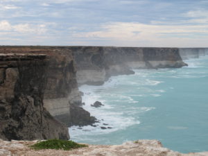
The Nullabor Cliffs looking east
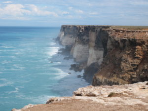
Nullabor Cliffs looking west
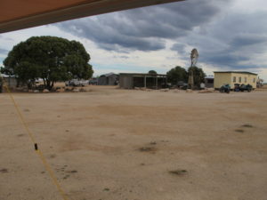
The Nullabor Roadhouse Campsite…quite a remote spot..!
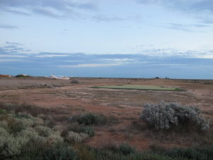
The Dingo Den golf hole at Nullabor Roadhouse with a light plane taxing across the fairway…!
After crossing Nullabor I made my way back to coast at the eastern end of the West Australian coastline. For the next two weeks I covered a large part of the South West corner of Australia starting in Cape Arid National Park through to beautiful Orleans Bay, Esperance, Stokes Inlet, Cheyne Beach, Albany, Denmark and then up to Stirling Mountain Range about 100km north of finally finishing in Perth. In the middle of this leg, I did an overnight 25km walk along the coast (small part of the 1000km long Bibbulmun Track)…great walk with wonderful sea views.
Another highlight in the Stirling ranges was a second encounter with a wedge tailed eagle. As I was descending Mt Toolbrunup a shadow passed over me. When I looked up I found a wedgetail eagle circling about 50m above me. I watched it for 5 minutes as it soared on the air currents…absolute master of thermal soaring without a single flap of its wings. After it disappeared over a ridge, it struck me that the eagle was probably looking me over as a potential meal. Fortunately it decided that I was too skinny for a meal and moved onto fresh pastures…!! Selection of photos follow.
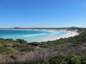
Beautiful Orleans Bay with crystal clear water and squeaky white sand beaches
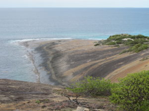
Interesting granite massifs sloping into sea at Cape Arid NP
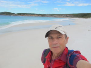
Selfie on Tagun Beach, Cape Arid NP
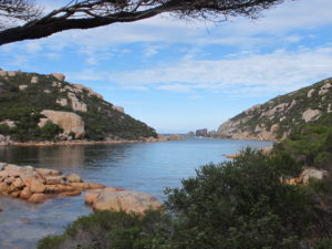
Pretty Inlet in Waychinicup National Park near Cheyne Beach
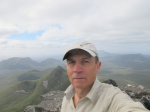
Selfie at top of Mt Toolbrunup, Stirling Ranges
This is the end of the Brisbane to Perth Sector. I am off to France on Friday 5 May for a hike through the Loire Valley. Details are recorded under Europe section.